Getting data off a cow past the last cell tower
There is no single best way to track cattle where there is no cell service. Here are the honest tradeoffs between GPS loggers, VHF, LoRaWAN, cellular, legacy satellite, and direct-to-satellite NB-NTN, and which one fits which study.

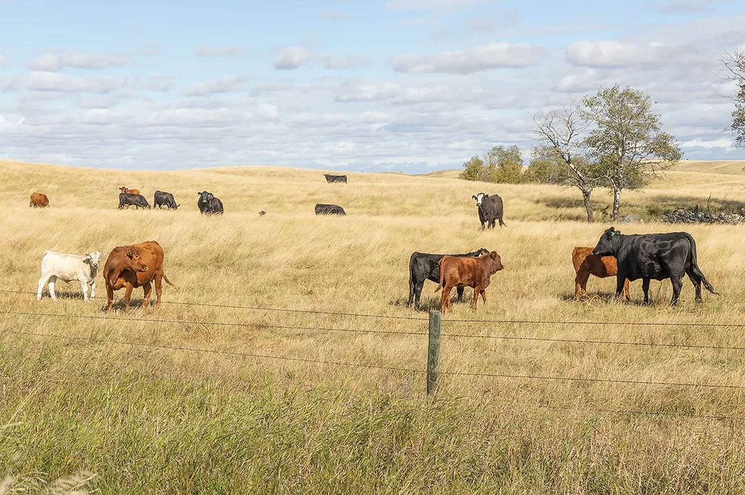
Stand in the middle of our test ranch in New Mexico and check your phone. No bars. No tower for miles, no power line, no fiber, nothing on a hilltop you could call a gateway. Twenty thousand acres of broken country, and the cattle a researcher most wants to study are the ones that drift farthest from anything you built. That is the whole problem in one sentence: the data stops at the edge of coverage, and the interesting animals live past it.
So how do you get location and behavior off an animal out there? There is no single right answer, and anyone who tells you otherwise is selling a radio. The study picks the tool. A two-week movement study on ten animals you will gather by hand is a different problem than watching a few hundred head year-round for calving and mortality. Here is how I actually think through it, and where we landed.
GPS store-on-board loggers: cheap, but you have to catch the animal again
The oldest trick that still works: put a GPS receiver and some flash on the animal, log a fix every few minutes, and read the data off when you get the device back. An Arduino-class open-source datalogger runs around US$125 in parts, and a full DIY research collar built from one lands somewhere in the US$150–300 range. The fixes are accurate and the cost per device is hard to beat.
The catch is recovery. You get nothing until the collar comes off, which can be weeks or months out, and only if you can find and handle that animal again. No real-time, no alerts, no operational use, and a total loss if the device walks off and you never see it again. For a short, bounded study where you round everything up at the end, a logger is honestly the sensible, cheap choice. For anything ongoing, it is the wrong tool.
VHF telemetry: a bearing and a beep
VHF radio telemetry is older still and refuses to die because it works. A transmitter on the animal sends a pulse; a tech with a directional antenna walks, drives, or flies a pattern and listens for the signal to peak. Ground-to-ground range is roughly 5–10 km depending on terrain and antenna gain, stretching to maybe 15–25 km when you receive from an aircraft.
What you get is a direction to the animal, not a dataset. No acceleration, no temperature, no timestamped track unless you go out and generate one yourself. It is fully manual and entirely bounded by how much field effort you can throw at it. When the real question is just “help me physically locate this animal,” VHF is still the right answer, and it pairs well as a recovery beacon bolted on top of a logger.
LoRaWAN: cheap tags, but you own the network
LoRaWAN is where a lot of ag-tech demos start, and I understand why. The tags are cheap and low-power, and vendors quote 5–15 km of range, “tens of km” in flat rural line-of-sight. The trap is in those last three words. LoRa does not go through a hill. On rolling, broken ground you need gateways on the high points to see down into the draws where cattle actually shelter, and every one of those gateways is yours to buy, place, power, and keep alive.
Vendors will claim a single well-sited gateway covers 10,000-plus acres. As a real-world anchor, Vence’s solar base stations for virtual fencing cover roughly 7,000–10,000 acres each in good terrain and cost on the order of $10,000 apiece. Across 20,000 unfenced, cut-up acres that is several base stations and a maintenance plan before you have tracked a single cow. And the ear-tag form factor is brutal on low-power radios: an independent 2025 study of a solar LoRaWAN cattle ear tag measured a live-animal GPS fix rate around 31%. Spec sheets imply far more than real ears and real terrain deliver. For a fixed study plot or the pastures near ranch HQ where you can justify the gateway, LoRaWAN is genuinely good. Spread across the back country, the infrastructure burden eats you alive.
Cellular LTE-M / NB-IoT: rich data, but only where the towers already are
If there is a tower in reach, cellular is hard to argue with. The chips are mature and cheap, power draw is low, and you get rich, near-real-time data. NB-IoT reaches deeper into the rural fringe than ordinary LTE, with range cited up to roughly 10 km in good conditions. One rural study found LTE-M covering about 99.9% of outdoor devices in its area. Read that carefully, though: it is coverage enhancement near existing towers. It does not conjure a tower where none exists, and the rangeland gaps are exactly the ground you care about.
There is also the cost shape. Licensed spectrum means every device carries a SIM and a subscription, so a whole herd becomes a recurring per-device line item, and the dead zones land precisely on the remote ground. We use Onomondo for our cellular SIM: a single non-steered eSIM that reaches 680-plus networks across 180-plus countries on one global APN with no roaming surcharges. It is genuinely good connectivity. It just cannot help where there is no terrestrial network at all.
Legacy satellite: works anywhere, priced for a handful
Iridium and Argos solve coverage outright: if the device can see sky, it has a link. The cost is the constraint. Iridium short-burst data starts around $0.04 per message for the first 30 bytes, and research Iridium-GPS collars bill a monthly fee plus a per-location charge. Argos is tiny by design, with a 256-bit max message (about 31 bytes of user data), tags often a few thousand dollars each, and operational fees on the order of a few euros a day. At the cheap, one-way end, solar Globalstar simplex ear tags exist, but a full charge supports only about ten reports and they are essentially uplink-only, with no real config downlink. Legacy satellite is the correct call for a handful of high-value research collars. It does not pencil out across a herd.
NB-NTN: the same standard chip, straight to satellite
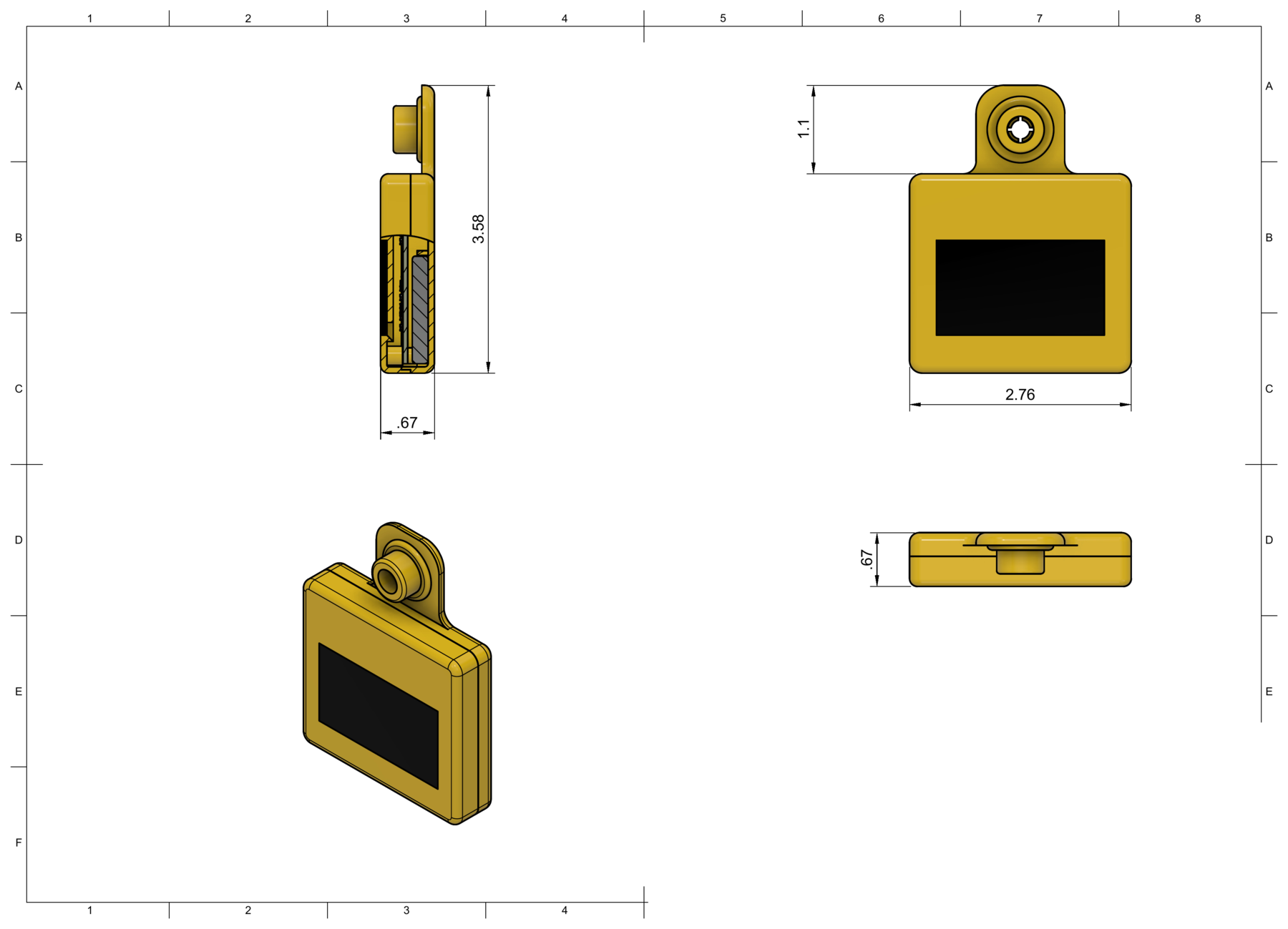
The newer option is 3GPP NB-IoT Non-Terrestrial Networks, standardized in Release 17. The same class of NB-IoT silicon (Nordic, Sony, Qualcomm, MediaTek, u-blox) talks directly to satellites with no gateway in between, and the economics are built for many devices rather than a few. We run a Nordic nRF9151, which supports terrestrial LTE-M/NB-IoT, Rel-17 NB-IoT NTN, and integrated GNSS in one SiP, over Skylo’s NB-NTN service on geostationary birds.
Be clear-eyed about the limits, because they are real. Bandwidth is in the 1–2 kbps class, far below terrestrial. It is store-and-forward with multi-second latency, no TCP/IP (you live on UDP or Non-IP Data Delivery), and coverage windows can be intermittent. Skylo’s best-case numbers (up to roughly 20 packets/minute, around 1024-byte packets, about 15-second latency) are a vendor ceiling, not what a power-starved solar tag on a marginal link sustains. Geostationary satellites sit over the equator, so from US latitudes they ride low in the southern sky, and low elevation angles hurt the link. The tech is also still maturing: production NTN firmware on the nRF9151 needs the A1 silicon revision that only began shipping around June 2026.
The part that drives every other decision is energy. On a solar tag, the uplink is the expensive thing you do. The 3GPP NB-IoT target of roughly 10-year life on a 5 Wh battery assumes friendly conditions. Tiny packets are inefficient: a ~1280-byte message spends on the order of 7x less energy per bit than an ~80-byte one, thanks to protocol overhead and post-transmit tail timers, and a marginal satellite link with low SNR pushes energy per message up fast. We feed the radio from an e-peas AEM10920 harvesting PMIC that pulls usable charge from as little as a few microwatts of PV, and we still budget transmits like they are expensive, because they are. A cow lying on the tag through a short winter day with dust on the panel is a coverage gap you designed for, not a surprise.
This is not theoretical anymore. In the last year, multiple livestock vendors have shipped Skylo-backed solar ear tags and NB-NTN collars, and direct-to-satellite virtual-fence collars are launching over emerging direct-to-cell satellite services. Direct-to-satellite for livestock is arriving across the board — which is exactly the point. The radio is becoming a checkbox, not a differentiator.
Seven questions that actually pick the technology
- Study-area size and terrain. Small and flat tolerates gateways; large and broken does not.
- Real-time or after-the-fact? If you can wait until recovery, a logger wins on cost.
- Scale. A handful of animals and a whole herd have opposite cost curves.
- Retention and recovery. If you might never catch the animal again, on-board-only storage is a gamble.
- Budget shape. Upfront gateway capex versus recurring per-device subscription is a real fork, not a rounding error.
- Field maintenance. Every gateway and battery swap is labor on country that is hard to reach.
- Who owns the raw data. Some closed satellite tags bar you from your own device’s raw output and route everything through a software partner.
Where we landed, and why
For the off-grid, whole-herd case we care about, we chose standards-based NB-NTN on the nRF9151 over Skylo, solar harvesting through the AEM10920 for years of no-swap life, behavior sensing from a Bosch BMI323 IMU (the accelerometer does the work; the gyro stays duty-cycled off to save power), low enough cost to cover a herd, and fully open data out the back. Standards-based matters because the radio layer is consolidating under giants and will keep shifting, and I would rather not have the tag married to one carrier. I have made the longer version of that argument, that the radio is commoditizing and the validated data is the lasting asset, in a separate post, so I will not rehash it here.
If you are speccing connectivity for rangeland work, start with those seven questions before you open a single product page. Match the tool to the study. The flashiest link is the wrong one if it cannot survive a winter on an ear, and the cheapest one is wrong if you can never get the device back.